


| Name | Kunda jõeoru outcrop |
| Type | outcrop |
| Country | Estonia |
| Parish | Viru-Nigula |
| Settlement | Kunda |
| Coordinates | 59.504375, 26.540767 |
| Coordinate precision | 100-1000 m |
| Coord. method | Est Land Board map server |
| Coord. agent | Aaloe, Aasa |
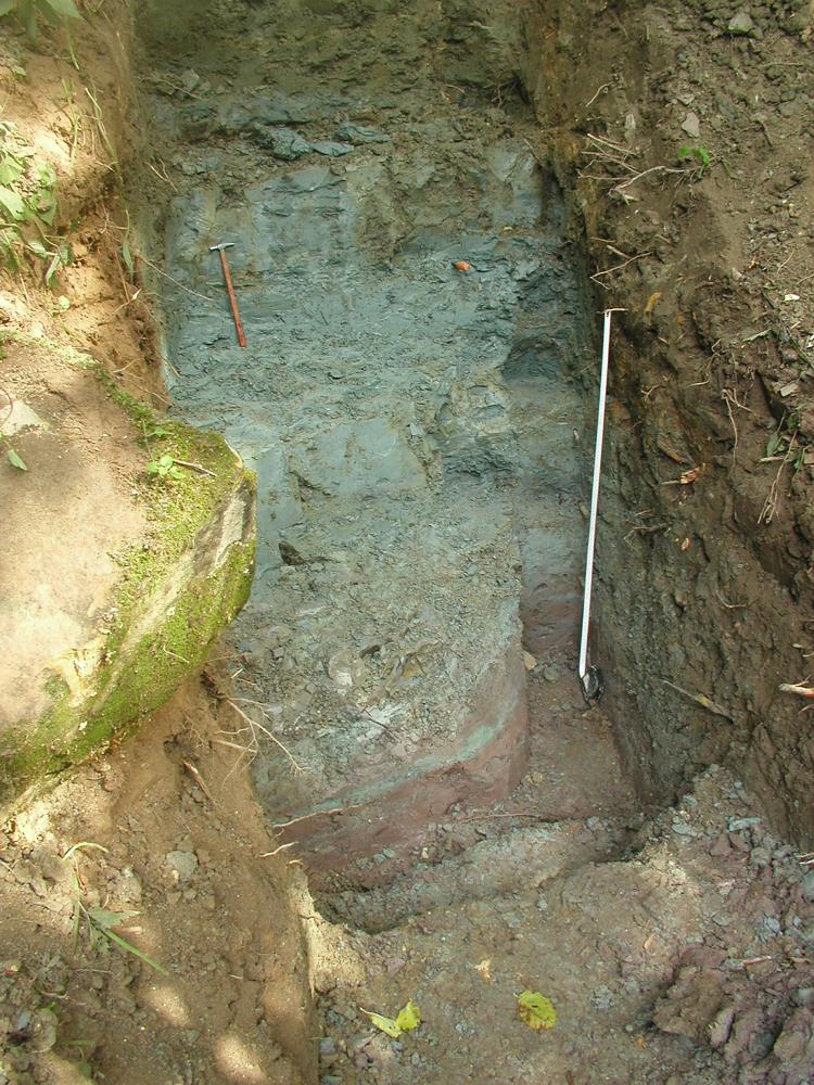
| Location remarks | Kunda jõe kanjonoru paremal kaldal ~350m alumisest jõesillast (Lontova poe juures) ülesvoolu |
| Strat. top | Lükati Formation |
| Strat. base | Lontova Stage |
| Remarks | Järsk oruveer, millel lihete tõttu paljandub aluspõhi. Paljandit kergelt puhastades avaneb sinisavi (Lontova kihistu) ülemine osa ja sellel Lükati kihistu. On Lontova kihistu neostratotüüp ja Lontova lademe tüüpalaks kogu Ida-Euroopa platvormil |
| Date added | 2004-06-08 |
| Date changed | 2016-11-04 |
Browse Geocollections
Partners


This site uses Matomo to analyze traffic and help us to improve your user experience. We process your IP address, viewed pages, load times and device information. This data is only processed by us.